Earth Science Modeling
Geohazard Models: Natural hazards and environment modeling
NGA offers foundational environmental data as well as scientific analysis of the environment and natural hazards, on both global and regional scales.
Global geohazard potentials and indications:
- Landslide
- Flooding
- Wildfire
- Seismic Liquifaction
- Regional version of global models
- Disease (e.g. ebola)
- Food security
- Crisis support
TDX-Hydro
- TanDEM-X Hydro (TDX-Hydro) is a hydrography data suite with a nominal 12m resolution. TDX-Hydro uses TanDEM-X data as an initial input. TDX-Hydro was produced by applying a custom hydrologic conditioning process that reduces the effects of vegetation and spurious noise, uses existing datasets to encourage correct stream placement, and adjusts the surface to allow for continuous downslope flow. Global streams and basins were then derived from the conditioned DEM. TDX-Hydro datasets do not currently cover Antarctica.
- The hydrography datasets are organized by continent and basin ID numbers. A shapefile corresponding to the basin ID numbers is located in the top-level directory.
- For further questions and issues, contact NGA Geoscience Division at SFNAGGeoscienceApplications@nga.mil
Get TDX-Hydro data
Deflection of the Vertical (DOV)
NGA provides worldwide gravity compensation data in support of U.S. military operations, mission planning, and safety of navigation. The 2 by 2 arc-minute spaced deflection of the vertical (DOV) is provided globally in terms of north-south and east-west components, with error estimates included. The unit of measurement is arc-seconds. This global coverage is repeated for a range of altitudes from 0 to 90,000 feet above mean sea level. This data is essential to the accuracy and effectiveness of high order inertial navigation systems (INS). It aids in the reduction of position and velocity error and improves orientation control when introduced into the INS solution. Deflection of the vertical (DOV) data is made available through the Defense Logistics Agency.
Arctic Gravity Project
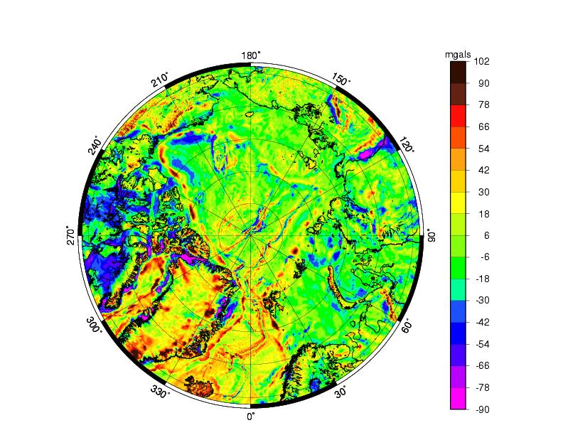
The Arctic Gravity Project (ArcGP) is an international effort dedicated to the compilation of a public-domain gravity grid of the Arctic gravity field north of 64° N. The focus of the gravity grid is the Arctic Ocean, Greenland, and the continental areas of North America and Russia north of 64° N. This international effort is being led by Rene Forsberg of the Technical University of Denmark and NGA of the USA, who were initially supported by a Special Working Group composed of members from ten different countries (USA, Canada, Sweden, Finland, England, Norway, Germany, Iceland, Russia, and France). The primary interest of the ArcGP is the compilation of state-of-the-art detailed free-air grids and was first made available to the general public in the year 2000 and updated in 2008. Historical information on the project, including previous grids and workshop/meeting minutes, are available on request. Please contact the Office of Geomatics with comments, suggestions, and feedback.

Arctic Gravity Project
| FILE/LINK | DESCRIPTION |
|---|---|
|
Arctic Gravity Project (2.4MB)
|
Zip archive containing Arctic Gravity Project data and documentation. |
TDX-Hydro
| VECTOR RIVER NETWORKS AND DRAINAGE BASINS | ||||
|---|---|---|---|---|
| TDX-Hydro Technical Document | ||||
| TDX-Hydro Data License | ||||
| Basin GeoJSON File with ID Numbers | ||||
Africa
|
Europe
|
Siberia
|
Asia
|
Australia
|
South America
|
North America
|
Arctic of North America
|
Greenland
|
|