Mission, Vision & Goals
- Enabling GEOINT accuracy through geodetic, geophysical and photogrammetric sciences and content.
- Advancing the objectives of our customers through science and services.
What is Geomatics?
- The science that determines the size and shape of the earth and the interrelation of three dimensional points on its surface using either direct or indirect techniques.
- Without Geomatics NGA cannot "Know the Earth..."
What is Geomatics?
Precise Imagery
WGS 84 derived imagery products
Geosciences & Elevation
Incorporate the physical earth into WGS 84
| World Geodetic System 1984 |
|---|
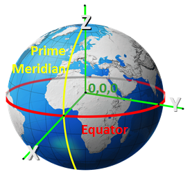 |
GNSS
Realization of WGS 84
Geodetic Surveys
Extend WGS 84 to the physical Earth
Authorities
Learn where Geomatics gets its authority to lead the geodetic sciences for the DoD and IC for:
- National Security
- Navigation Information
- Maps, Charts, etc.
- National Missions
- Systems